Video

Spirit Of Asia : Mrauk-U, The Last Capital of Arakan Kingdom


Spirit Of Asia : Mrauk-U, The Last Capital of Arakan Kingdom, One of the Richest Archaeological Sites in Asia.

Spirit of Asia will take you turn the pages of history . The former capital of the Kingdom of Rakhine/ Rakhaing/ Arakan Kingdom .

Start with the primary cereal empire city Dhanyawaddy. The origin of the source for Mahamuni Buddha Image . Buddhist sculpture as a precious gem of Southeast Asia .

Then other city is Vaishali period. Another Kingdom Territorial Rakhine And culminating with the Mrauk U . City of Through the ancient world to remember.

Mrauk U (Mruak U) , the former capital of the ancient kingdom of Rakhine . Built in the early 1973 to the fall of Burma in the year 2378 for more than 354 years in this glorious civilization in the past.

• The City of Takoma Mrauk U . Also filled with more than 140 ancient temples such as Wat Phaya all candles Khan City Vuitton Paya ( temple eighty ) measured at Dawes Rd. ( Temple of the Tooth Relic ) Temple ninety (GLOBE Tong serpent ) and various indigenous villages .
(http://www.youtube.com/watch?v=ErBfscnaV-c )

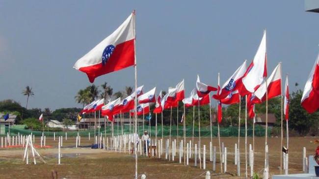
By Arakan Indobhasa Posted in Video

Arakan History


Arakan History

Vesali

Vesali is one of the oldest ancient cities in all of Burma, dating from AD 327 to AD 1018. It was founded by Dvan Chandra who, according to an Anandacandra Inscription from 729 AD, was believed to have been a descendant of the Hindu god Shiva.

Vesali is noted for being the first Arakanese kingdom to use currency, almost a millennium before it was introduced by other civilizations in Burma. Gold and silver coins, inscribed with the Chandra dynasty emblem and the word “king” in Sanskrit have been found and dated back to the Vesali era. The Vesali kingdom had a far-reaching trade network, exporting goods to the Arab and Persian kingdoms and beyond.

Laymro Era

From 794 AD – 1413 AD several Arakanese capitals were founded along the Laymro River. The first, Sambuwauk, was founded by King Nga Tone Munn, who was the son of the last king of Vesali, Sula Chandra. In 818 AD his second cousin Khattathun seized the throne and moved the capital to Pyinsa, where it stayed for 285 years.

Over the next 148 years, the capital was re-located five times to different spots along the Laymro River. In 1406 the second Laungkrauk city, the capital at the time, was invaded by the Burmese and King Munn Saw Munn fled; according to an early 1940s account written by Nga Me for Arthur P. Phrayre (then the governor of Arakan), the King was given refuge in Bengal by Sultan Nazzir Udin Shah. In 1429, with the Sultan’s assistance, Munn Saw Munn led an army back into Arakan and restored its independence. This version of events has been disputed due to the lack of evidence of a strong link between the Arakan and Bengal kingdoms of the time. What is certain is that shortly after Munn Saw Munn returned to Arakan, the capital was moved to Mrauk- U and arguably the most prosperous era in Arakanese history followed. Continue reading

Arakan History


INTRODUCTION

Image

Largely unknown to the Western world for much of its tur¬bulent history, Arakan played a pivotal role in the exchange of cultures and religions between India and Southeast Asia. For over a thousand years the region which now forms the Rakhine State of the Union of Myanmar (Burma) was an inde¬pendent state whose rich history is only slowly being paid the attention it deserves. Stretching along the Bay of Bengal, from the Naaf River which separates it from Bangladesh to Cape Negrais in southern Burma, it occupies the narrow strip of land to the west of the mountains of the Arakan Yoma (Range). Land and sea routes connected it with Bengal to the west and Burma proper to the east, routes that were travelled by peo¬ples, religions and cultures. When its neighbours were weak, Arakan was able to expand its influence along the coast to the east, west and south. At other times strong and aggressive neigh¬bouring states would drive the Arakanese back to their home¬land in the north or, at times, seek to conquer them.

Arakan’s heartland was in its north, based on the rich alluvial flood plains of the adjoining Kaladan and Le-mro valleys. The earliest cities were in the Kaladan valley, backed by hills and facing west, and were thus open to influence from India and beyond. Subsequently cities were founded west of the Le-mro River, more accessible to Burma proper. The greatest city, Mrauk-U, bestrides the gap between these two valleys and thus could control both. All these cities were accessible to the Bay of Bengal through the tidal Mayu, Kaladan and Le-mro Rivers and their tributaries. Continue reading

Nandaw Pagoda


nandaw pagoda

The pagoda lies on Nandaw mountain which is in the left river bank of Thandwe river and one mile far away from the north of Thandwe. This pagoda is also a prophetic pagoda of lord Buddha.

The lord Buddha prophesied Anan Da, “Dear Anan Da, the pagoda will be called Nandaw pagoda enshrining my rib relic after I had attained Parinibbanna since I had ever been a king of partridge in a previous life of mine.”

The governor Min Pyar of the city of Dawrawaddy built the pagoda in 763 AD in accordance with Buddha’s prophecy. Rakhine successive kings: king Maha Soe, king Ra Zar Gyi and king San Da Thu Dham Ma, renovated the pagoda in 1323 AD. 1626 AD and 1676 AD respectively. Townspeople of Thandwe renovated it twice in 1849 AD and 1878 AD respectively.

The original height of the pagoda is 6 feet, but the pagoda was encased by the donors, therefore, in the present, it measures 40 feet high and 110 feet in circumference. The pagoda is octagonal in shape at the base and the upper part of the pagoda is conical. The pagoda has the same shape with Andaw and Sandaw Pagodas in relation to Buddhs’s prophecy.

Andaw Pagoda


While Buddha was resting on the top of Tanttawmu mountain, he prophesied, “Dear Anan Da, I had ever been the kings of human beings and the kings of animals many times in my previous lives in the city of Dawrawaddy. Among them, I had ever been a king of rattlesnake in a previous live of mine in Pathura mountain where is in the north-east of this mountain I stand, therefore, the pagoda called Andaw, will be built enshrining my molar relic after I had attained Parinibbanna.”

This pagoda is situated on the top of Andaw mountain where is in the left river bank of Thandwe river and one mile far from Thandwe. The governor Za Choke of the city of Dawrawaddy, built the pagoda enshrining the molar relic in 762 AD according to Buddha’s porphecy. Rakhine successive kings such as king Maha Soe, king Ra Zar Gyi and king San Da Thu Dham Ma, renovated it. The residents of Thandwe and Andaw villagers renovated the pagoda again in 1870 AD.

The form of Andaw pagoda is octagonal in shape at the base. The pagoda measures 46 feet high and 244 feet in circumference. The upper part of the bell-shaped deom is conical. The whole pagoda doesn’t have any decorations and the pagoda court is also narrow. There is the small bell in the north-east of the pagoda court and the stone slab which is 15 feet in circumference, is at the eastern cliff of the mountain outside the pagoda court. That stone slab is a part of the umbrella of the ancient pagoda. The square-formed hole was made at the centre of the stone slab. Each side of the hole in the form of square, is 2 feet 2 inches in length. The square-formed hole of the stone slab, was used for the inner central pillar of the pagoda.

There is a prayer hall at the base of the mountain. The Buddha image which is made of bricks and cement, is dwelling in the prayer hall. U Shwe Bu, the lieutenant general of Myanmar force, built the prayer hall in the peace of the ancient religious edifice in the early 19th century. The design of the prayer hall is strange because the design of the common Buddhist building and the design of the islamic mosque, are mixed up. The prayer hall is called Pharahla. There is a corridor to enter the hall in the form of square, and the ceiling was made in the form of dome.

Sandaw Pagoda


sandaw pagoda

The pagoda is located on the steep mountain which is in the left river bank of Thandwe river and one mile fur from Thandwe. This pagoda is also a prophetic pagoda of Buddha. Buddha prophesied Anan Da, “Dear Anan Da, the pagoda called Sandaw will be built enshrining my hair relic after I had gained Parinibbanna as I had ever been a king of the bird of paradise in Manikaytha mountain in a previous life of mine.”

The governor Min Nyo Khin of the city of Dawrawaddy built the pagoda in AD 784 according to Buddha’s prophecy. Rakhine successive kings such as king Maha Soe, king Ra Zar Gyi and king San Da Thu Dham Ma renovated it. The residents of Thandwe renovated it again in 1849 AD and 1876 AD respectively. The form of the pagoda is octagonal in shape. It measures 65 feet in height and 180 feet in circumference at the base. The upper part of the bell-shaped dome, is conical and there are no decorations, caves and porches. The pagoda court is enclosed with the octagonal-shaped wall. There are three entrances around the wall, but only one entrance has the brick stairway. The brick stairway provides an access to the pagoda from the base of the mountain. It has 204 steps and the balustrade of the stairway is 3 feet high. The small bell is in the north-east of the pagoda. The contemporary religious buildings are occupying the base of the mountain. Among them, the distinctive building is the building in the form of the cave cemetery of the Mohanmedan. The inner room is square, and the roof and the ceiling are spherical.

SanDaMuni Buddha Image Between


sandamuni buddha image

King Athor Ka of Padalipoat kingdom excavated seven Sarwat at Buddha relics king Azar Ta That buried in Razargyo kingdom. Sarwat is a container (the unit of measurement). In accordance with the advice of monk Shin Maha Mauk Ga Li Poat Tiek Tha, he sent the Buddha relics to the Buddha’s prophetic places for building the pagodas.

King Thu Ri Ya Sak Ka of Dynyawaddy kingdom and king Athor Ka, were simultaneous kings. King Athor Ka ruled his country from BC 326 to BC 286. King Thu Ri Ya Sak Ka ruled Dynyawaddy from BC 316 to BC 272. King Athor Ka sent monk Shin Bar Ku La and monk Shin Maha Teik Tha bringing Buddha relics to king Thu Ri Ya Sak Ka to build the pagodas in the prophetic places of Buddha in Dynyawaddy. The two monks gave him the Buddha relics and the replica of Sandamuni Buddha image which Buddha cast by himself while he was alive. According to the two monk’s instruciton, he built 248 pagodas int he prophetic places of Buddha who visited Rakhine. The pagodas were as high as the bull. The successive kings of Rakhine reconstructed them into the larger pagodas by encasing the original pagodas.

After building the pagodas, king Thu Ri Ya Sak Ka cast the image similar to Sandamuni Buddha image of India in the nine leftover jewels of casting Manamuni Buddha image. That Buddha image was named Sandamuni because it was cast like Sandamuni Buddha image of India. The king worshipped the Buddha image by building the stone cave for it in the east of the palace. The successive kings of Dynyawaddy period worshipped the Buddha image like Mahamuni Buddha image. The successive kings of Vesali period also worshipped it. And then, king Min Saw Mon moved the capital of Rakhine from the city of Laungkyat to Mraukoo. He built five pagodas around the city of Mraukoo as city-settlement pagodas. Moreover, he took Sandamuni Buddha image worshipeed by the successive kings of Rakhine to Mraukoo. The stone Buddha image was put in the original place of Sandamuni Buddha image. That stone Buddha image is also called Sandamuni Buddha image. Nowadays, that Buddha image is near Taungoo village. King Min Saw Mon worshipped Sandamuni Buddha image making the cave on Barkual hill in which Arahat Ashin Bar Ku La stood and prophesied that Mraukoo would be founded. The British occupied Rakhine state after the first Anglo-Myanmar war. In such time, the British took away the bronzeware such as bronze Buddha images, the bronze bells and the bronze gongs from Rakhine state. And then, some townselders hid some Buddha images and other valuable bronzeware. Those townselders hid Sandamuni Buddha image as well by taking it sneakily from Barkual hill at night. Nobody knew where Sandamuni Buddha image was hidden after those townselders had been dead. Continue reading

Vesali Buddha Image


vesali buddha image

King Maha Tine San Dra founded the capital of Vesali in AD 327. The name of Maha Taing San Dra was written as the name of Dwe San Dra in Anandachandra stone inscription pillar. The chief queen of king Maha Tine San Dra was Thu Pa Bar Day Wi, the descendant of Tharkiwan clan of Kapilawat kingdom. The chief queen spoke to the king humbly that she wanted to worship Thakkyamuni Buddha image worshipped by descendants of Tharkiwon clan in Kapilawat kingdom. The king sent the ministers and the high officers to Kapilawant kingdom to covery Thakkyamuni Buddha image.

They conveyed the Buddha image in the sailing ship. When they reached Theinseetauntwaykhanaung, the Buddha image fell into the water as the ship wrecked due to breaking out of the storm there. Although they looked for it in the water, they didn’t find it because the water was very deep. When the ministers and the high officers got back to the palace, they spoke to the king humbly that the Buddha image had fallen into the water. When the queen Thu Pa Bar Day Wi heard that news, she was contracted with the mental illness because her wish didn’t come true. And then, the Buddha image was made of single stone by the king in AD 327 and he let his wife worship the Buddha image instead of Thakkyanmuni Buddha image. But, the queen made a solemn wish donating light and flowers to Buddha image.

She prayed to Buddha image, “Although I cannot worship Thakkyamuni Buddha image of my country in this existence, may I worship it as soon as I am born as a princess in the next life.” The queen was reincarnated as the princess of king Min Ra Zar Gyi and queen Shin Ma Hnaung after she had been dead. As soon as the princess had been born, she was able to worship Thakkyamuni Buddha image by finding it in the water.

The Buddha image erected by king Tine San Dra in Vesali, was called Vesali Sutaungpyit Buddha image as the Buddha image fulfilled the queen’s wish. In the ancient time, the image was woshipped by placing it in the stone cave. But the cave had already ruined. The prayer hall was built of bricks in the east outside the perfumed chamber. Two Buddha images in the prayer hall, are Buddha images taken from Shwetaung pagoda and Ngwetaung pagoda. The perfumed chamber and the prayer hall are fenced with the wall. There are entrances in the south and the east. The Buddha images is in the form of sitting on the lotus throne. The images is 17 feet high. The pagoda board of trustee takes care of it.

Mingalardatshwegu and Koenawon Pagoda


mingalardatshwegu pagoda

King Kheik Ta Thin, the nephew of king Su La San Dra, founded Pyinsa after fall of Vesali. In those days, Arahat Thit Sa Van Da Wa practised meditation in the cave near the city of Pyinsa during three months of lent. That cave still can be seen unitl now. The cave is called Ngetkhaung. That Arahat Thit Sa Van Da Wa practised meditation in the cave at the base of Lamaded mountain as well. Lastly, he practised meditation dwelling in Thamoatdawiri of present Sittwe. The word “Bandawagu” gradually became changed to Bandawgu, and in finally, Badawmaw at the present time. Those names are called regarding Arahat Thit Sa Van Da Wa. He attained Parinibbanna in Thiripatpada mountain of Sanga mountain ranges. King Kheik Ta Thin cremated the cropse by himself. He built a pagoda on Thiripatpada mountain enshrining relics of Thit Sa Van Da Wa and others in AD 818. The pagoda is octagonal in shape at the base and it is surrounded by eight spherical pagodas which face eight directions. The pagoda is called Koenawon because it has nine pagodas in total.

The Buddha image in the form of Pacinka mudra, is in the cave monastery of the east. The Buddha image in the form of Oattarabawdi mudra is in the cave monastery of the south. The Buddha image in the form of Latkhanadipa mudra is in the cave monastery of the south-west corner in which Buddha image is pointing to his sole with his right hand’s index finger. The Buddha image in the form of gaining Parinibbanna, is in the cave monastery of the west. The Buddha image in the form of preaching Dhamma to Yatkhas, is in the cave monastery of the north-west corner. That mudra is called Yatkhadamma mudra. The Buddha image in the form of Abaya mudra is in the cave monastery of the north-east corner. It is necessary to repair the surrounding pagodas because they are ruins.

And, king Kheik Ta Thin built Mingalardatshwegu pagoda in the western hill of Koenawon pagoda enshrining the relics of Arahat Thi Sa Van Da Wa and Buddha relics in AD 818. The pagoda is bell-shaped in structure. The base of the pagoda is octagonal in shape and the stone sculptures are at the corners of the pagoda. The entrance cave is in the east. The stone Buddha image in the perfumed chamber, is five feet high. The pagoda is maintained by the board of trustee of the pagoda.

Mahahti Buddha Image


mahati

Laymyo period had four capitals. Pyinsama was the first capital of Laymyo period and it last 285 years from AD 818 to AD 1103. Purain was the second capital of Laymyo period and it last 57 years from AD 1103 to AD 1160. Nayrinesara was the third capital of Laymyo period and it last 86 years from AD 1160 to AD 1246. Laungkyat was the fourth capital of Laymyo period and it last 184 years from AD 1246 to 1430 AD. Those four cities were situated along Izananadi river, thus, those periods are called Laymyo period in reference to those four cities. The river is also called Laymyo river in reference to those four cities.


The fifth descendant of king Lat Kya Min Nan, the founder of Purain city in Lyamyo period, was king Kaw Li Ya. He did Athaditha donation. The stone inscription written with two inches-sized words on the large natural rock of Kawliya mountain, can still be seen until now. Although the rock layers had detached from the large rock, the inscription on the rock can originally be seen marvellously. Such king Kaw Li Ya erected the Buddha image three miles away from the south-west of Purain city and seven miles away from the south of Marukoo city in AD 1123. The hill the image stands, is fifty feet high. That Buddha image was sculpted in the local rock mountain by cutting it. Such locality was called Ngakaukra because the king said, “Ngakaukra.” It means that he found the stone easily to sculpt the Buddha image. After the long time had been moving, nowadays, that locality is called Ngarakauk.

King Kaw Li Ya placed the Buddha image on Sandapatvata mountain and covered it with the stone umbrella. He worshipped the image by placing it in the stone cave. Such Buddha image was named as Mahahti because it was covered with the stone umbrella.

During the first Anglo-Myanmar war, Buddha image damaged into fragments, and the whole cave also destroyed as the British captain fired the cannon at the cave in which Myanmar soldiers defended. The village situated in the place in which the British captain Baw Raw had stationed, is called Thwraw village. The villagers near Mahahti Buddha image, rebuilt the image combining the fragments they found, but they had to substitute the necessary things with bricks and cement as they didn’t find all original fragments of Buddha image. The Buddha image is eight feet high. The local villagers built a pagoda as well. The prayer hall is in the east of the pagoda. There are two ways to the pagoda: the king way and the queen way. The flat stones were laid in order on the road from the harbour to the stairway of the pagoda because the king came to it by barge for his pilgrimage. Nowadays, the board of trustee maintains the pagoda.